![](/images/other/stat-length.png)
![Trail Walking Autrans-Méaudre en Vercors - Autrans - Gève - Bec de l'Orient - La Buffe - Photo](https://media.geolcdn.com/t/1900/400/01b0a32d-f745-4bcd-a16d-40bc9fb8f206.jpg&format=pjpeg&maxdim=2)
Autrans - Gève - Bec de l'Orient - La Buffe
Philindy26
User
![Length](/images/other/stat-length.png)
![Max alt](https://static1.geolcdn.com/siteimages/upload/files/1508320355ic_sort_altitude_max_24dp.png)
![Uphill gradient](https://static1.geolcdn.com/siteimages/upload/files/1508320355ic_sort_den_pos_24dp.png)
![Km-Effort](/images/other/stat-length.png)
![Min alt](https://static1.geolcdn.com/siteimages/upload/files/1508320355ic_sort_altitude_min_24dp.png)
![Downhill gradient](https://static1.geolcdn.com/siteimages/upload/files/1508320355ic_sort_den_neg_24dp.png)
![Boucle](https://static1.geolcdn.com/siteimages/upload/files/16400158638029165_repeat_loop_refresh_sync_direction_icon.png)
![Walking](https://static1.geolcdn.com/sitytour/trail-icons/101.png)
5h00
Difficulty : Difficult
![Scan this QR Code to open this trail in the SityTrail application](https://capi.geolives.com/qq0zvz2zws4bq2lad0pu/sitytour/trails/3800650/qr.png?size=200)
FREE GPS app for hiking
About
Trail Walking of 15.8 km to be discovered at Auvergne-Rhône-Alpes, Isère, Autrans-Méaudre en Vercors. This trail is proposed by Philindy26.
Description
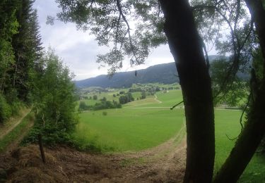
Départ du parking de Gève (1289 m), commune de Autrans.
Géolocalisation (Google Maps) : https://goo.gl/maps/BpAuMGdVToWiEtg9A
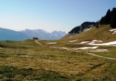
Monter au Bec de l'Orient (1554 m) par le refuge de Gève (1288 m) et continuer sur la Route Forestière du Cyclone. Passer par la Patte d'Oie (1301 m), le Cyclone (1330 m), la Vira Gros Jean (1352 m), Sous les Cartaux (1370 m), Charbonnière (1395 m) et L'Avion (1430 m).
Là, vous trouverez la stèle commémorative du crash d'un avion de la Royal Air Force en février 1944.
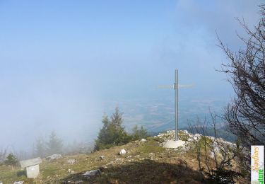
Continuer à gauche pour atteindre le Camp des Carteaux, la Cheminée (1520 m) où vous rejoindrez le GR 9 pour arriver au Bec de l'Orient (1554 m).
En suivant le GR 9 (sentier très aérien qui suit les crêtes), repartir en direction de la Buffe (1623 m) par le Pas Brochier (1460 m), Sous le Pas Brochier (1452 m), le Pas de la Clé (1509 m) et la Grande Brèche (1550 m).
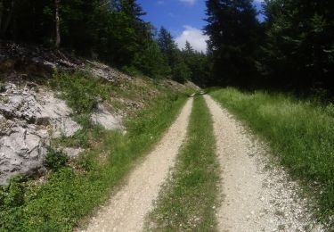
Descendre par le Près du Mortier (1543 m) et Sous le Pas (1505 m) pour rejoindre la Route Forestière de la Grande Brèche. En la suivant retour au parking par le Sous la Brèche (1502 m), la Route de la Grande Brèche (1380 m) et le Refuge de Gève.
Variante à partir de Sous le Pas (1505 m) pour rejoindre le parking :
Passer par Sur le tunnel (1414 m) et le Tunnel du Mortier (1390 m). et suivre la D218 sur environ 500 mètres en direction du téléski du Mortier. Puis continuer à droite pour rejoindre le téléski de la Grande Brèche 2 (1361 m). Suivre cette piste jusqu'à la Route de la Grande Brèche qui vous remmènera au parking de Gève.
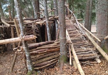
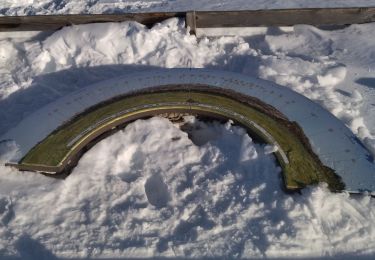
Positioning
Comments
Trails nearby
![Trail Walking Engins - Circuit pas de la Lose, du Tracollet, de l'Ours avec un retour par le passage de la Grande Combe - Photo](https://media.geolcdn.com/t/375/260/e578919b-c81c-4fe4-99cc-8260409f6f79.jpg&format=jpg&maxdim=2)
![Walking Walking](https://static1.geolcdn.com/sitytour/trail-icons/101.png)
Walking
![](/images/other/stat-length.png)
![](https://static1.geolcdn.com/siteimages/upload/files/16400158638029165_repeat_loop_refresh_sync_direction_icon.png)
![Trail Snowshoes Autrans-Méaudre en Vercors - Autrans: Gève - Bec de l'Orient - Photo](https://media.geolcdn.com/t/375/260/4e878d82-c145-4502-8e75-629fc9885006.jpg&format=jpg&maxdim=2)
![Snowshoes Snowshoes](https://static1.geolcdn.com/sitytour/trail-icons/504.png)
Snowshoes
![](/images/other/stat-length.png)
![](https://static1.geolcdn.com/siteimages/upload/files/16400158638029165_repeat_loop_refresh_sync_direction_icon.png)
![Trail Walking Autrans-Méaudre en Vercors - Autrans : Pas de l'Ours - Photo](https://media.geolcdn.com/t/375/260/ext.jpg?maxdim=2&url=https%3A%2F%2Fservices.sitytrail.com%2FGeolivesWS%2FDownloadMedia.ashx%3FTrailID%3D419322%26Media%3D20150509154225.jpg)
![Walking Walking](https://static1.geolcdn.com/sitytour/trail-icons/101.png)
Walking
![](/images/other/stat-length.png)
![](https://static1.geolcdn.com/siteimages/upload/files/16400158638029165_repeat_loop_refresh_sync_direction_icon.png)
![Trail Walking Engins - La Molière - Vercors - Photo](https://media.geolcdn.com/t/375/260/ext.jpg?maxdim=2&url=https%3A%2F%2Fservices.sitytrail.com%2FGeolivesWS%2FDownloadMedia.ashx%3FTrailID%3D103760%26Media%3D6503_1.jpg)
![Walking Walking](https://static1.geolcdn.com/sitytour/trail-icons/101.png)
Walking
![](/images/other/stat-length.png)
![](https://static1.geolcdn.com/siteimages/upload/files/16400158638029165_repeat_loop_refresh_sync_direction_icon.png)
![Trail Walking Autrans-Méaudre en Vercors - Traversée des Rochers de la Clé, Bec de l'Orient - Photo](https://media.geolcdn.com/t/375/260/ext.jpg?maxdim=2&url=https%3A%2F%2Fservices.sitytrail.com%2FGeolivesWS%2FDownloadMedia.ashx%3FTrailID%3D103329%26Media%3D5325_1.jpg)
![Walking Walking](https://static1.geolcdn.com/sitytour/trail-icons/101.png)
Walking
![](/images/other/stat-length.png)
![](https://static1.geolcdn.com/siteimages/upload/files/16400158638029165_repeat_loop_refresh_sync_direction_icon.png)
![Mountain bike Mountain bike](https://static1.geolcdn.com/sitytour/trail-icons/202.png)
Mountain bike
![](/images/other/stat-length.png)
![](https://static1.geolcdn.com/siteimages/upload/files/16400158638029165_repeat_loop_refresh_sync_direction_icon.png)
![Mountain bike Mountain bike](https://static1.geolcdn.com/sitytour/trail-icons/202.png)
Mountain bike
![](/images/other/stat-length.png)
![](https://static1.geolcdn.com/siteimages/upload/files/16400158638029165_repeat_loop_refresh_sync_direction_icon.png)
![Trail Walking Autrans-Méaudre en Vercors - 38 au dessus d Autrans ..cascade - Photo](https://media.geolcdn.com/t/375/260/d94ffa49-7c7e-4aff-a40e-79ece6fde182.jpg&format=jpg&maxdim=2)
![Walking Walking](https://static1.geolcdn.com/sitytour/trail-icons/101.png)
Walking
![](/images/other/stat-length.png)
![](https://static1.geolcdn.com/siteimages/upload/files/16400158638029165_repeat_loop_refresh_sync_direction_icon.png)
![Trail Walking Engins - 38 engins Molière neige - Photo](https://media.geolcdn.com/t/375/260/34c2e7ec-30ac-4d6d-b1dc-53a50bca429f.jpg&format=jpg&maxdim=2)
![Walking Walking](https://static1.geolcdn.com/sitytour/trail-icons/101.png)
Walking
![](/images/other/stat-length.png)
![](https://static1.geolcdn.com/siteimages/upload/files/16400158638029165_repeat_loop_refresh_sync_direction_icon.png)